Unmanned Aerial Vehicles (UAVs) will be playing an important role in this campaign. The teams bring a variety of unique platforms to the campaign, each of them outfitted with the instruments they need to help them achieve their scientific tasks.
SUMO (GFI/UiB):
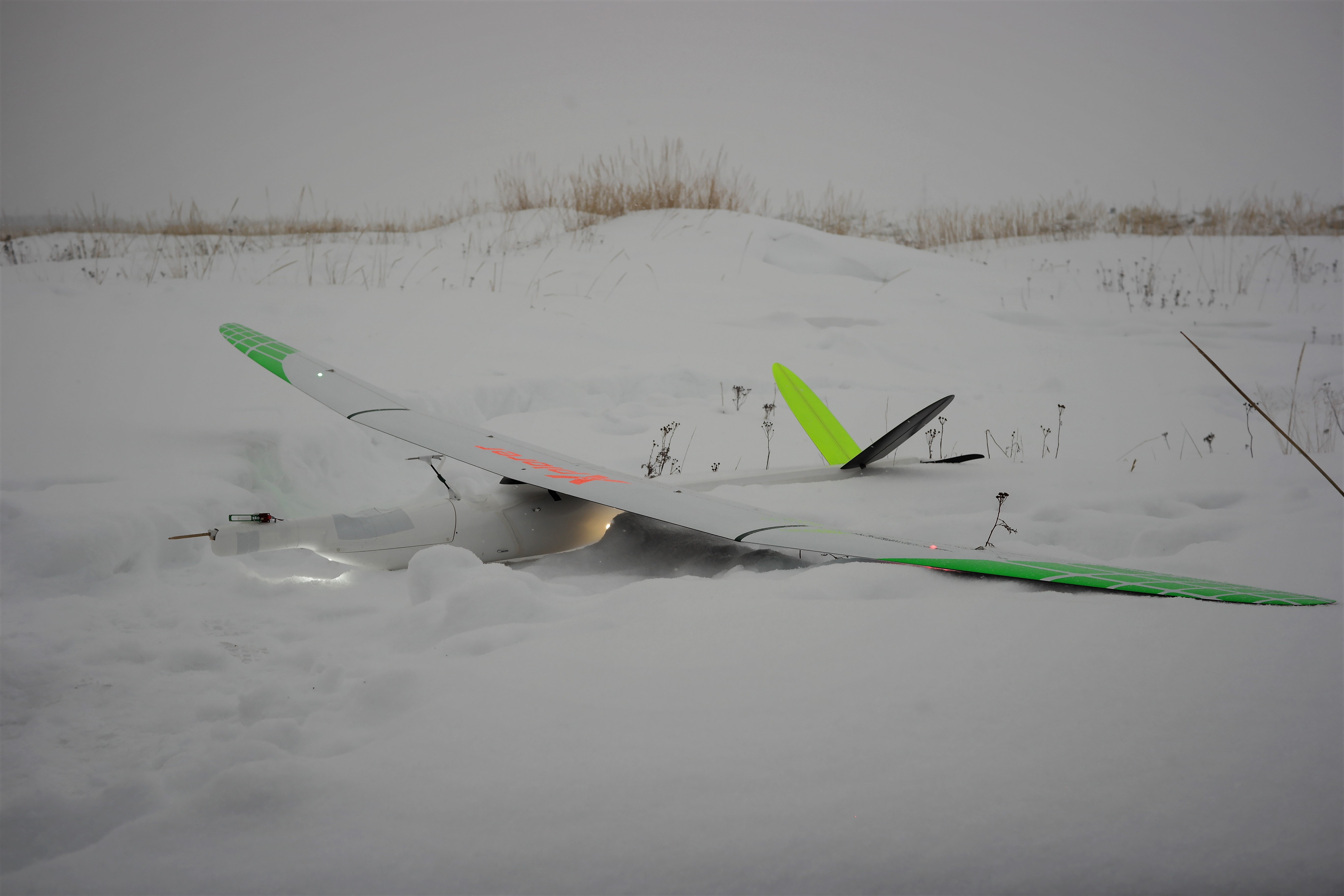
The Small Unmanned Meteorological Observer aircraft is a well established atmospheric profiling system for temperature, humidity and wind. SUMO will the provide the measurements that will serve as atmospheric background information for the campaign, up to 1800 m above ground.
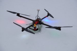
SUMO prepared for a night flight during the campaign.
For more information, check out: http://www.uib.no/en/rg/meten/55620/sumo
bebop2met (GFI/UiB):
A small and handy profiling system for the atmospheric surface layer based on the commercially available quadcoptersystem Bebop Parrot2. Equipped with a “sensor backpack” it can provide profiles of temperature, humidity and wind in the lowest 200 m of the atmospheric boundary layer.

The bebop2met ready for take-off.
Tuffwing (OU):
The University of Oklahoma operates two fixed-wing aircraft based on the Tuffwing Data Mapper. Each is equipped with a Pixracer running ArduPilot for autonomous flight. Moreover, both measure the wind speed and direction during flight. One of the Tuffwing aircraft carries a MicaSense Rededge-M multi-spectral camera. For ISOBAR, the camera is being used for terrain mapping. The other Tuffwing is outfitted with two sensors for measuring CO2 (Senseair K30-FR) during flight. Values of CO2 aloft are compared against values recorded on a LI-COR 840A. The camera and CO2 monitoring equipment can be replaced with temperature, humidity, and pressure sensors to facilitate thermodynamic sampling.

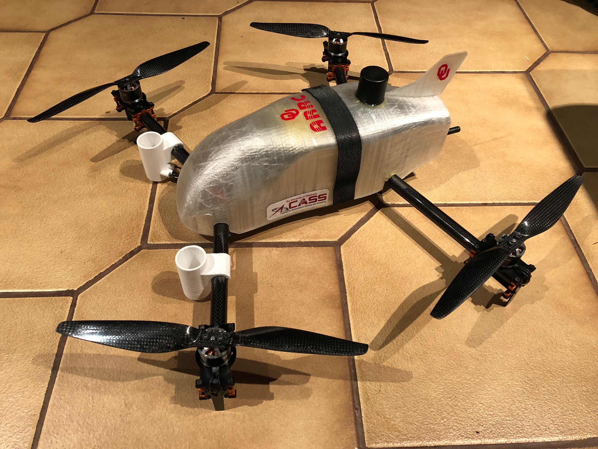
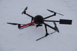
CopterSonde 2.1 (OU):
CopterSonde 2.1 is a quad-rotor vehicle developed at the University of Oklahoma within the Center for Autonomous Sensing and Sampling (CASS). with the intention of sampling the thermodynamic (pressure, temperature, and humidity) and kinematic (wind speed and direction) state of the lower atmosphere (surface up to 2,000 m). Using on-board differential GPS package, the position of the vehicle is known to an accuracy of a few centimeters during flight. Thermodynamic sensors are aspirated using the downwash from the copter’s propellers.
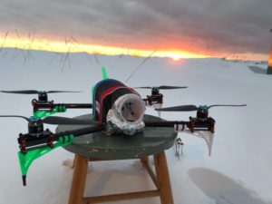
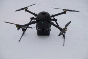
CopterSonde 2.2 (OU):
CopterSonde 2.2 is a variant of CopterSonde 2.1. Using slightly rearranged flight hardware it utilizes a ducted fan to draw in air to aspirate the thermodynamic sensors. The CASS team is exploring the effect of sensor placement on data quality. Because of the ducted fan, the exterior shell has a different aerodynamic design than that of CopterSonde 2.1.
MASC (UT):
The third generation of the Multi-purpous Airborne Sensor Carrier (MASC-3), operated by the environmental physics working group of the University of Tübingen, is equipped with an INS and a five-hole-probe to measure the 3D wind vector at turbulent scales. Furthermore a fast temperature sensor is on board and humidity and surface temperature are measured. Usually the missions consist of long horizontal racetracks in several heights starting from 15 m to usually 300 m AGL.
Q13 (OWL):
The Q13 multicopter operated by Ostwestfalen-Lippe University of Applied Sciences is a quadrcopter system equipped for this campaign with a temperature, humidity and a wind sensor.
Q17 (OWL):
The Q17 multicopter from Ostwestfalen-Lippe University of Applied Sciences is used to sample the surface temperature of the ice and therefore is equipped with a combined thermo and visible spectrum camera.
PlusQ18 (OWL):
The PlusQ18 is designed for a long flight time and already flew one hour continuously. It is equipped with temperature, humidity and optionally wind sensor.